Project Overview
Funding Agency: NASA
Begin Date: July 1, 1998
End Date: December 31, 2002
Project Final Report Complete:
Click here to view or download the final report for the Agricultural Colonization in the Ecuadorian Amazon project.
Research Symposium in Quito, Ecuador – June 10, 2004:
Click here to view a description of the symposium conducted by the Ecuador Project team in Quito on June 10, 2004.
The initial phase of this project actually began in 1990 with Dr. Richard Bilsborrow’s first round of a socio-economic and demographic (SED) household survey in the northern Amazonian region of Ecuador, also known as the northern Oriente. In 1998, Bilsborrow and Walsh received funding from NASA to return to this area and conduct a second phase of the SED survey, this time with a distinct geographic component, thus creating a spatially explicit longitudinal study for this frontier region.
The primary goal of this project is to identify the social, economic and demographic determinants of land use and land cover (LULC) change in this region. While we are largely interested in deforestation, all vectors of change are considered important, including reforestation and shifting agriculture.
In 1999, a SED household survey was conducted on the same fincas, or farms, that were originally visited in 1990. The survey included two questionnaires, one for the jefe, or head of household, and one for the esposa, or the spouse. The questions mirrored those from the 1990 survey, asking questions regarding land use, farm production, interaction with labor markets, migration, household composition, fertility, and other important topics. The survey is structured in such a way that it longitudinally follows the plot of land rather than the household. The reason for this is that during the 9 years between surveys, many of the original fincas had been subdivided. Owners had split off part of their original property to give to children or sell to new in-migrants. This resulted in almost twice as many households on in 1999 as in 1990, but the same number of original plots of land, referred to here as finca madres.
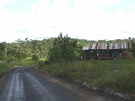
Returning to these locations was initially a challenge. The only locational information regarding these original survey fincas was the name and number of the sector, or cooperative of fincas, in which they are located; the number of the finca itself; the name of the finca owner in 1990; and a rough sketch map of the surveyed fincas within the sector. In order to facilitate the survey teams in navigating back to these fincas, Survey Instrument Image Maps (SIIMs) were created. Click here for a detailed description of these SIIM products. The SIIMs worked well enough to deliver the survey teams at the least to the general neighborhood of the survey fincas, if not to the exact location itself.
Once on a finca each survey team, which consisted of one male and one female interviewer, would administer their questionnaires to the jefe and esposa, respectively. After completing the questionnaires, the male interviewer sat with the farmer and, with the aid of the SIIM products (both air photo and satellite image maps), created sketch maps of the LULC on the farmer’s land. One sketch map was created for the present time (1999), and one sketch map was created for 1990 or the year that the farmer settled on his land, if later than 1990. Click here for more information on the 1999 survey sketch maps.
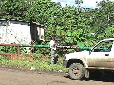
Following the questionnaires and sketch maps, each survey team collected a GPS point at the farmer’s household. GPS points were also collected at the front two corner points of the finca madre, closest to the road. Only one set was collected per finca madre, regardless of the number of subdivisions it contained. These GPS corner points were used later to generate the finca madre property boundaries.
In 2000, a community survey was completed for 65 communities in the study area. All of the communities that were surveyed were referenced in one or more of the Esposa surveys as providing some service to them and their family, and are linked to those particular Esposa questionnaires. The community questionnaire inquired about available infrastructure, local population, and economic growth within the community.
The generation of spatial data for this project began in 1998 and continued during and after the household and community surveys. This included the digitization of roads, rivers and elevation contours from topographic maps; purchase and processing of aerial photographs and satellite imagery; and the processing and integration of survey GPS data. The Spatial Analysis pages contain more information on this aspect of the project. The spatial component of this project provides a geographic context for the inherently non-spatial data collected during the survey. The SED survey data from both the household survey and the community survey have been integrated with the spatial data within a Geographic Information System (GIS).