Project Overview
Funding Agency: National Institutes of Health (NIH)
Begin Date: April 1, 2000
End Date: May 31, 2003
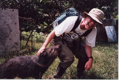
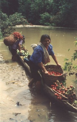 Since the early 1970s, Bilsborrow has worked in the Ecuadorian Amazon region, or Oriente, undertaking demographic and economic research on migration and colonization, including two large-scale surveys of migrant farmer households in 1990 and 1999, the latter funded through NASA. For a more complete picture of the land use changes in this ecologically renowned region, it was necessary to understand patterns of land use among the indigenous inhabitants of the northern Oriente, as well as the diversity that exists both inter- and intra-ethnically within our sample of five indigenous groups-the Quichua, Shuar, Cofán, Secoya, and Huaorani. This was the purpose of the NIH proposal, to enable us to collect comparable cross-cultural data on indigenous Amazonian populations, to compare and contrast these data with the previously collected colonist information, and to achieve a broader, regional understanding of the forces contributing to deforestation in the Oriente. One of the main objectives of the study is to determine the demographic, socio-economic, and biophysical factors influencing the intensity of land use by both migrant colonists and indigenous populations in Ecuador’s Amazon. Such a tall order required a multi-disciplinary and collaborative approach. Our methodological approach uses both quantitative and qualitative methodologies from demography, landscape ecology, anthropology and political ecology. Data collection, carried out in 2001, involved (1) an ethnographic study in eight indigenous communities, conducted by 12 Ecuadorian ethnographers over the course of five months(providing a depth of understanding), and (2) household and community surveys (providing a breadth of understanding) in 28 additional communities. To provide a spatial component to the research, Global Positioning System (GPS) receivers were used in the field to obtain geographic coordinates of communities, households, agricultural plots, and other features of interest. In addition, satellite imagery was processed to determine land use and land cover (LULC) types and patterns, landscape features, roads and other infrastructure. The geo-referenced socio-economic and demographic survey data and biophysical and remotely sensed data are being integrated within a Geographic Information System (GIS) to derive measures of LULC for multivariate analyses and spatial analyses at the landscape level.
At the end of the research, for these indigenous populations, we expect to have an understanding of:
- demographic changes, including fertility/mortality rates, migration patterns and family planning
- household economics: assets, market activities and earnings, aspirations, subsistence activities (e.g., hunting and fishing), sharing and exchange
- land use and agricultural patterns: land and forest cover, plot sizes and location, gardening practices and agricultural production, use of external inputs, raising of domestic animals, labor inputs and time allocation
- social organization of land and resources: common property, private property, rules and sanctions, the social relations of land
- location of key infrastructure and how it relates to all the factors above.