Project Overview
Funding Agency: Andrew W. Mellon Foundation
Begin Date: August 1, 2002
End Date: July 31, 2003
Preliminary analyses of the longitudinal household surveys indicate there has been a widespread process of land subdivisions since 1990 on sample fincas located along main roads and in close proximity to Lago Agrio, the central community within the region, and the other towns in the region. This process of subdivision, resulting in substantial plot fragmentation (and a decline in mean plot size), is due to both sales of parts of plots to new agricultural colonists migrating into the region and to subdivision of plots among the children (heirs) of settlers. Other interesting differences in farm conditions between 1990 and 1999, which have implications for this analysis, includes: (1) the near doubling of the population, linked to the subdivision of property, (2) expansion of off-farm employment due partly to the expansion of the service sector in towns, (3) decrease in the average distance from farm to market, indicating that fincas closer to market towns tend to be subdivided more, (4) expansion of the electrification grid along main roads, and (5) a dramatic decline in farm size through land subdivision, thereby affording the new owners less land in forest and pasture and more in the intensive forms of land use – perennials (mostly coffee) and annual crops.
Preliminary spatial simulation models developed by Messina and Walsh (2001) through cellular automata or CA procedures indicate the important role of Lago Agrio, and of road networks that connect farms to community services and off-farm employment to changes in LULC in the region and particularly around the central community within the region. The models indicate the effects of urbanization on the absorption of land and the increasing fragmentation of agricultural plots through population growth and agricultural extensification, resulting in forest areas being more patchy with increasing distance from Lago Agrio, where urbanization dominates, but at some distance threshold from Lago Agrio forest regains its LULC dominance in the landscape matrix and patchiness subsides. Areas surrounding Lago Agrio are developing a land use pattern characterized by a mix of crops, pasture, and residential/commercial development, while high-density forest areas, previously in large tracts, are being converted to heterogeneous low to medium density forest tracts on fincas intermixed with agriculture and pasture. House lots or solares have been created by “parcelization” near several major towns within the region, reflecting incipient urbanization (Walsh et al. 2002).
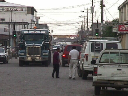
For this study, we focus on the provinces of Sucumbios and Orellana. The 1990 censuspopulation of the Amazon region as a whole, including the other provinces, Napo, Pastaza, Morona Santiago, and Zamora Chinchipe, was 371,000, of which 273,000 was rural. The early results of the 2001 census show a population of 547,000, indicating continuing high population growth. The population of the Amazon region of Ecuador has grown at over double the national rates in the last three intercensal periods, at 8% per year in 1974-1982, 5% per year in 1982-1990, and 3.5% in 1990-2001. Lago Agrio, in Sucumbios, is the largest city in the Oriente, but as of 2001, its census population was 34,000.
Data
In this proposed research, we extend our examination of human-environment interactions in the Oriente through a Geographic Information Science (GISc) perspective in which (1) a remote sensing time-series from 1973 to 2001 is used to represent LULC dynamics, (2) GIS coverages to characterize local resource endowments and connections of farms to other farms and to communities within the region, (3) longitudinal socio-economic and demographic survey at the household-level conducted in 1990 and 1999, and (4) a community-level survey, administered in 2000 to community leaders, farmers, teachers, women, and health workers in places ranging from tiny communities to the largest city, Lago Agrio, that collected data on population, labor force, land, transportation linkages, and infrastructure.
Methods
A CA system consists of a regular grid of cells, each of which can be in one of a finite number of k possible states, updated synchronously in discrete time steps according to a local interaction rule. The state of a cell is determined by the previous states of a surrounding neighborhood of cells (Wolfram 1984). The rule contained in each cell is essentially a finite state machine, usually specified in the form of a transition function or growth rule that addresses every possible neighborhood configuration of states. The neighborhood of a cell consists of the surrounding (adjacent) cells. Within CA and the broader theoretical framework of Complexity Theory, it is expected that there will be both non-linear and hierarchical relationships among the biophysical, spatial, and socio-economic factors that govern LULC change within the Oriente.
Preliminary space-time simulations of LULC patterns have been developed for the Northern ISA (containing Lago Agrio) and Southern ISA (containing Coca) through the use of CA models (Messina and Walsh 2001) that did not incorporate any household- or community-level data from the surveys.
New efforts are currently underway to incorporate social data from the household- and community-level surveys. In addition to these new data inputs, the next version of the CA model will incorporate a more detailed LULC classification scheme and additional parameters to better recreate the patterns of land use visible in the satellite imagery.
Expected Outcomes
From the preliminary model runs, LULC is significantly affected by the urban environment. While only Lago Agrio, the central city, has been included in prior efforts, the importance of smaller communities will likely be confirmed as they tend to act as socio-economic attractors in which lands are converted from forest to agriculture, and then to urban uses through spatial diffusion processes. A fragmentation of forest and a transition to a mixed land use has been observed in field studies. Modeling this behavior through a technology that is spatially- and temporally-explicit, and sensitive to “what if” scenarios, offers insights on the interplay between urbanization and LULC dynamics in frontier environments that has important policy implications regarding deforestation, agricultural extensification, and urban development.
References
Messina, J.P. and Walsh, S.J., 2001. 2.5D Morphogenesis: Modeling Landuse and Landcover Dynamics in the Ecuadorian Amazon. Plant Ecology, 156(1): 75-88.
Walsh, S.J., J.P. Messina, K.A. Crews-Meyer, R.E. Bilsborrow, and W. Pan. 2002. Characterizing and modeling patterns of deforestation and agricultural extensification in the Ecuadorian Amazon. In Linking People, Place, and Policy: A GIScience Approach, ed. S.J. Walsh and K.A. Crews-Meyers, 187-214. Norwell, MA: Kluwer Academic Publishers.
Wolfram, S., 1984. Cellular Automata as Models of Complexity. Nature, 311: 419-24.