The Global Positioning System has been an invaluable resource for the CPC Ecuador Projects. GPS is useful for gathering geographic coordinates of places and phenomena that are not recorded on maps or in any other spatial form. It can be used to capture individual locations, which are represented by points; linear features, such as roads, which are represented by lines; or areas, such as agricultural plots, which are represented by polygons.
Initially, the two most important uses of GPS in the NASA-1 project were the collection of the household and property boundary points, and the collection of geodetic control. The household and property boundary points were collected so we would know the location of each household that was interviewed, as well as the front two corner points of their finca. The finca corner points were used in conjunction with satellite imagery to delineate the boundary of each finca madre. This allows us to link the socio-economic and demographic (SED) survey data to either the household point or the finca madre polygon.
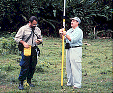
Geodetic control was collected at locations that were visible on the satellite imagery and were static, or unchanging. Such features included road intersections, bridges, oil wells, and airport runways. After collecting hundreds of coordinates around the study area, we rectified the satellite imagery using a standard image processing software package.
Following the collection of these two sets of data, GPS was used to gather additional information that was difficult to capture in any other way. The first of these were coordinates of areas of land use and land cover (LULC) that are of interest to us for classification purposes. After locating an area of a particular class of LULC (e.g. primary forest, coffee, or pasture), coordinates were collected at the center of the patch, or if possible, around the perimeter of the patch. This data was used in conjunction with information gleaned from survey sketch maps to classify the Landsat imagery.
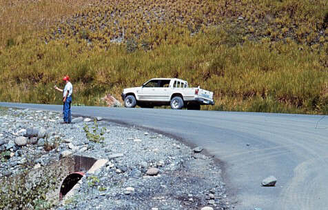
Locations of new roads were also collected using GPS receivers. If a road was encountered in the study area that does not appear on our maps, the GPS receiver would be turned on and a new file would be opened. The road would be driven in its entirety, with the GPS file being closed at the end of the road.
GPS coordinates were collected in the center of each community in the colonist study area, as well as any places of interest in the community, such as lumber mills, health clinics, churches, and recreational locales.
For the NIH project in the indigenous areas, GPS receivers were used to collect the locations of the surveyed households, their chacras, the center of each community, and places of interest in the community.
All GPS data gathered in the field were error-corrected using post-processing differential correction procedures. The correction files were obtained from a base station in Quito.
For more information on the Global Positioning System and how it works, go to the National Air and Space Museum siteon GPS.