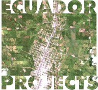
These projects use a variety of remotely-sensed data products. By far, the foundation of the remote sensing has been Landsat imagery. Our Landsat time series ranges from 1973 (Landsat MSS) up to September of 2002 (Landsat 7 ETM+). Our overall study area falls within the area of four Landsat scenes:
- Path 8 Row 60
- Path 8 Row 61
- Path 9 Row 60
- Path 9 Row 61
While the Path 9 Row 60 images contain the vast majority of the NASA Project’s colonist study farms and roughly half of the NIH Project’s indigenous villages, the other three scenes are necessary to complete the coverage of our area.
More recently, we have begun to acquire imagery with both higher spatial and spectral resolutions. In 2000 and 2001, we acquired several IKONOS images (4m multispectral and 1m panchromatic spatial resolution) covering a sampling of our study farms and one of the sampled indigenous villages. We are also in the process of adding QuickBird imagery (2.44m multispectral and 0.61m panchromatic spatial resolution) and ASTER imagery (14 spectral bands) to our database.
Aerial photos also make up a portion of our image products. Our set of photos date from 1989 and 1990, and are in both hardcopy and digital formats.
The Metadata page contains links at the bottom to detailed listings of our various imagery products.
